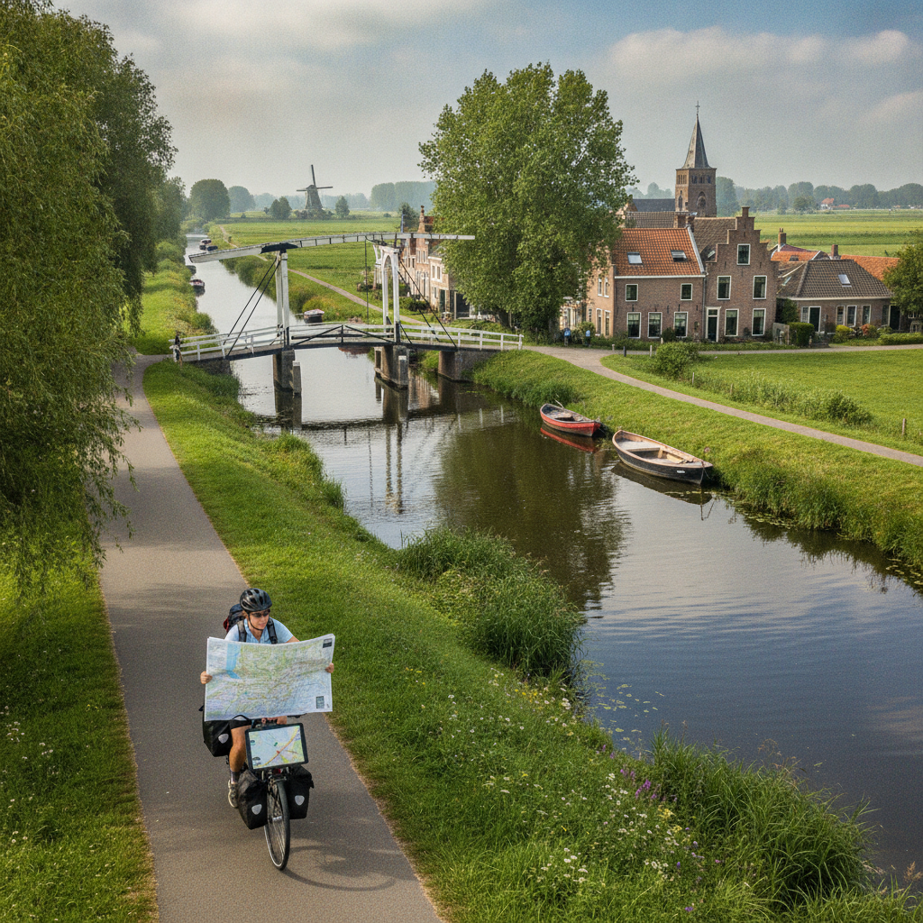
Few travel experiences match the quiet pleasure of cycling along a canal at your own pace, stopping when something catches your eye, and arriving somewhere beautiful without having paid for a guided tour to get there. The Netherlands and Belgium have built some of the most cyclist-friendly infrastructure in the world, and the network of canal towns connecting cities like Amsterdam, Haarlem, Ghent, and Bruges rewards slow, self-directed exploration in ways that packaged itineraries rarely do. With the right free tools and a bit of preparation, planning a multi-day route through this region is genuinely within reach.
Understanding the LF Route Network Before You Start
The Netherlands has a nationally maintained long-distance cycling route system called the LF routes — short for *Landelijke Fietsroutes* — and they are one of the best-kept secrets in European cycle tourism. These numbered routes pass through canal-side villages, dyke paths, and historic town centers, and they are fully documented on the free planning tool **Fietsnet** (fietsnet.nl). Before opening any app, spend time on this site understanding which LF routes pass through the regions you're most interested in. LF1 and LF2, for instance, trace coastal and inland waterway corridors that connect Dutch and Belgian towns with remarkable continuity.
Using the Knooppunt Junction Network for Flexible Planning
The numbered junction system — called *knooppunten* in Dutch — is the foundation of cycle navigation across both the Netherlands and Flanders. Junctions are numbered nodes placed at intersections throughout the cycling network, and you plan a route simply by writing down a sequence of numbers. The **Routeplanner Fietsnet** tool lets you string together junction numbers on a digital map for free, generating turn-by-turn directions, elevation profiles, and estimated distances. This system means you can change your plan mid-ride without getting lost. It also means you don't need a dedicated GPS device — a screenshot of your junction sequence and a basic sense of direction is often enough.
Layering Belgian Canal Routes With Visit Flanders Tools
Once your route crosses into Belgium, the equivalent resource is the **Visit Flanders cycling planner**, available at visitflanders.com. Flanders uses the same knooppunt junction system, so the transition between countries is seamless on the ground. The Visit Flanders tool lets you filter routes by theme — including waterway routes specifically — and it integrates points of interest like windmills, breweries, and historic lock houses that rarely appear on general-purpose maps. Combining both planning tools gives you a route that flows from Dutch canal towns like Leiden or Delft into the Flemish waterway corridor leading toward Ghent and Bruges without a single gap in the network.
Downloading Offline Maps So You're Not Dependent on Data
Once you've planned your route, download it for offline use before you leave. The free version of **Komoot** allows you to import GPX files and save route segments for offline access, which matters when you're cycling through rural stretches between towns where mobile data is inconsistent. Both Fietsnet and the Visit Flanders planner allow GPX export. Alternatively, **OsmAnd**, built on OpenStreetMap data, lets you download entire regional map packs for free and search for knooppunt junction numbers directly within the app. Having your route accessible offline removes a layer of anxiety that can otherwise distort the pleasure of traveling slowly.
Timing Overnight Stops Around Canal Town Logistics
The canal town network between the two countries includes a wide range of accommodation options, but availability tightens considerably in summer, particularly in Bruges and Amsterdam. Plan your overnight stops around towns that sit naturally on your route rather than forcing detours. Smaller stops like **Damme**, a quiet canal village just outside Bruges, or **Gouda** in South Holland, offer genuine character without the booking pressure of larger cities. Use your mapping tools to check the distance between potential stops and aim for daily distances that feel comfortable rather than ambitious — somewhere between 40 and 70 kilometers tends to suit mixed-terrain canal riding well.
Reading Elevation and Surface Data to Avoid Unpleasant Surprises
The Netherlands is famously flat, but the route into Belgium can introduce modest climbs, particularly once you move south of Ghent toward the Flemish Ardennes. The Routeplanner Fietsnet tool displays elevation profiles for each planned segment, and the Visit Flanders planner categorizes routes by difficulty. Pay attention to surface type as well. Some canal towpaths are packed gravel rather than asphalt, which is manageable on a hybrid bike but punishing on a road bike with narrow tires. Both free tools indicate surface type in their route detail view, and taking ten minutes to check this before finalizing a segment saves considerable frustration on the road.
Incorporating Rest Days Without Losing Momentum
Building a rest day into a multi-day cycling route isn't a concession — it's sound planning. Canal towns like Ghent reward an extra day spent wandering on foot, exploring the medieval harbor district and the network of quiet bridges that most passing cyclists don't stop to see. Use your rest day to recalibrate the second half of your route if your original plan feels too ambitious or not ambitious enough. Both the Dutch and Flemish mapping tools allow you to re-plan segments from any point, so adjusting on the fly costs nothing and preserves the spontaneity that makes self-guided travel genuinely different from a scheduled tour.
Marking Points of Interest Before You Leave Home
Free tools like **Google My Maps** allow you to create a personal layer of saved locations that you can reference alongside your cycling route. Before departing, spend an hour marking canal locks, historic windmills, waterside cafés, and bike repair shops along your corridor. This layer becomes a personal companion map that no commercial tour operator would replicate, because it reflects exactly what you find interesting. Importing your GPX route into Google My Maps and overlaying your saved points gives you a single reference document you can share with a travel companion or consult at a glance during a rest stop.
Planning a self-guided cycling route through the Dutch and Belgian canal towns is less complicated than it first appears, and the free tools available make the process genuinely accessible to anyone willing to spend a few evenings with a map. The knooppunt network, the regional planning platforms, and reliable offline apps work together to create a planning infrastructure that commercial tour operators charge significantly for — and the result is a route that belongs entirely to you, shaped around your pace, your curiosity, and the particular stretch of canal light that makes you want to stop and stay a little longer.